김연규 소장품 - 한국해를 한국만(Gulf of Corea)으로 표기한 지도
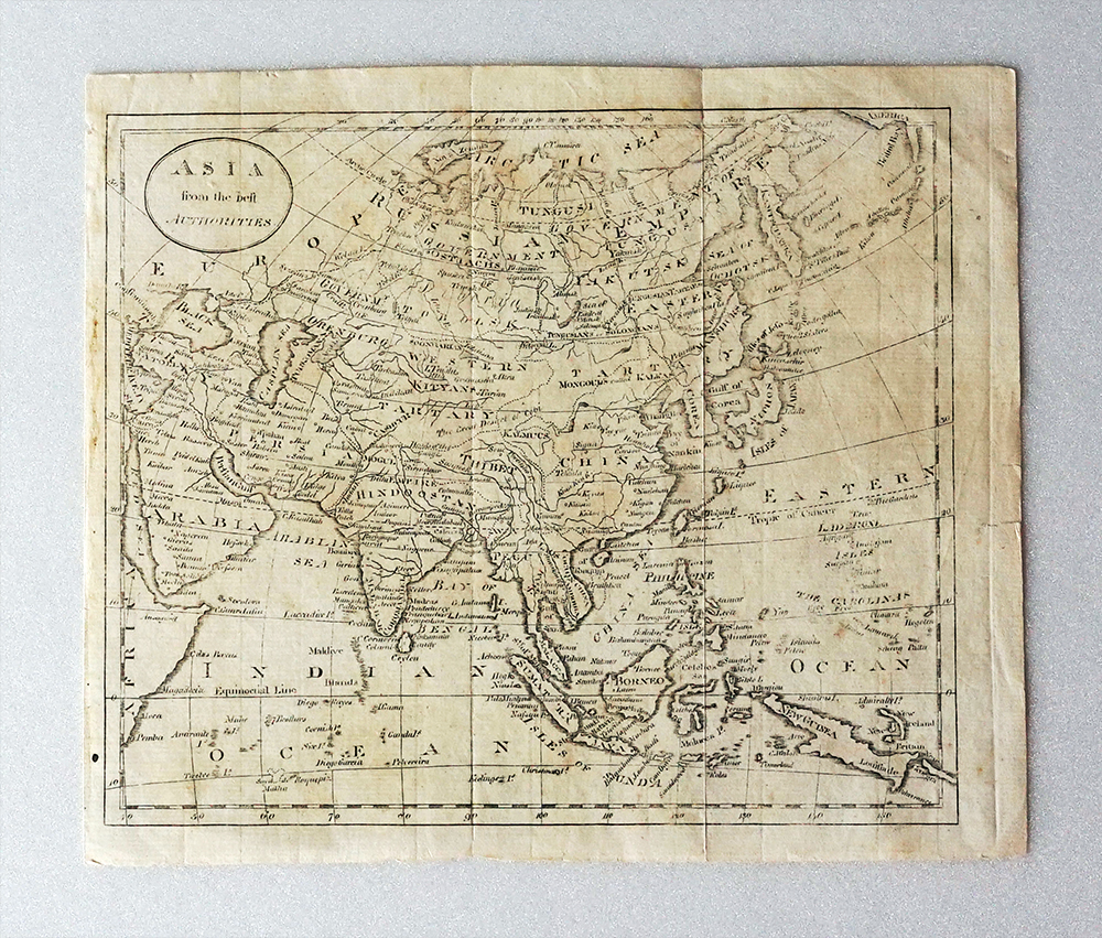
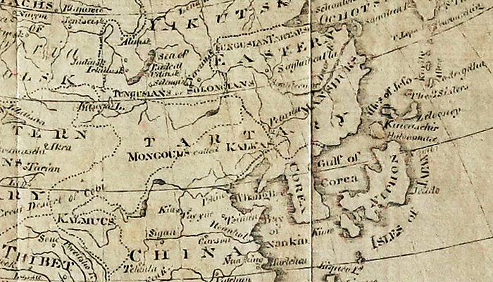
아시아
Asia from the best authorities
England, John Russel, 1796, 25×20㎝
러셀의 지도로 당시에 구트리(William Guthrie)가 출간한
A New Geographical, Historical and Commercial Grammar and Present State of Several Kingdoms of the World에 수록된 아시아 지도로 축척은 1:59,700,000이다.
동해 해역은 한국만(Gulf of Corea)으로 표기하고, 조선과 청나라 사이의 국경이 표시되어 있음.